The geotechnical team arrives at your Coventry site with a set of stainless-steel sampling tubes, a portable hand auger for shallow access, and cool boxes to preserve moisture content. For deeper profiles, a tracked percussion rig is used to retrieve undisturbed samples from the Mercia Mudstone and Keuper Marl sequences that underlie much of the city. Each sample is logged on site for colour, consistency and odour before being sealed and transported to the UKAS-accredited laboratory. There, the material undergoes systematic soil classification according to BS 5930:2015 and the Unified Soil Classification System (USCS), supported by the AASHTO system when the project involves road pavement design. This initial classification step is critical because Coventry's glacial till and river terrace deposits vary laterally within metres, and a misidentified layer can lead to bearing capacity errors of over 50%.
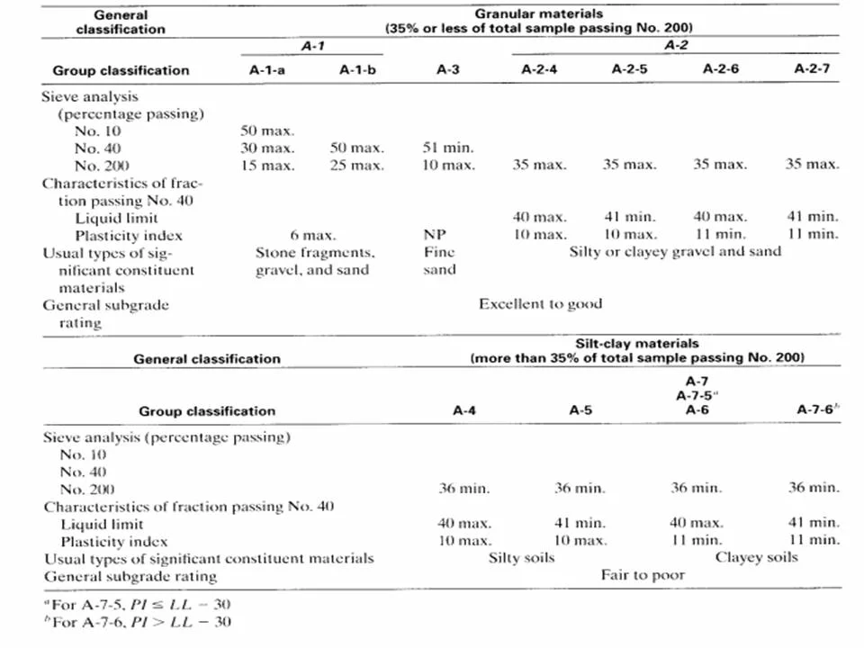
A misidentified glacial till layer in Coventry can lead to bearing capacity errors exceeding 50%. Systematic USCS and AASHTO classification prevents that.