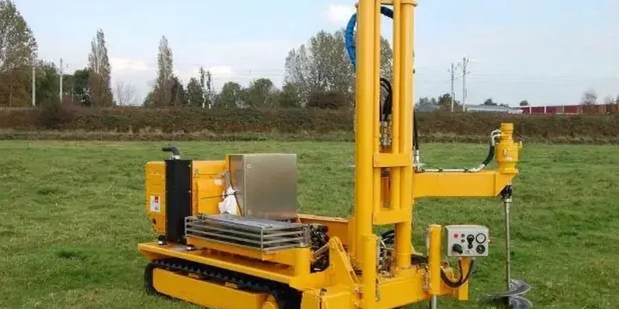
Ground investigation in Coventry forms the essential first step in any construction or civil engineering project, providing critical data about subsurface conditions that directly influence design, safety, and cost. As a city undergoing significant regeneration — from the Friargate development to expanding residential estates and infrastructure upgrades — understanding what lies beneath the surface has never been more important. Comprehensive site investigation helps engineers identify potential hazards such as unstable soils, groundwater issues, or contamination, ensuring that foundations are appropriately designed and risks are mitigated before work begins. Without this knowledge, projects face increased likelihood of delays, structural failures, or unforeseen expenses during construction.
Coventry's geology presents a varied and sometimes challenging picture that demands careful investigation. The city sits largely on Triassic Mercia Mudstone Group deposits, comprising reddish-brown clays and siltstones that can exhibit shrink-swell behaviour with seasonal moisture changes. Overlying these bedrock formations, Quaternary glacial deposits including till, sand, and gravel create a complex superficial geology across different parts of the city. The River Sherbourne corridor and its tributaries have deposited alluvial soils in valley areas, which can be soft and compressible. Additionally, Coventry's industrial heritage means made ground and potential contamination are common considerations, particularly in former manufacturing and engineering sites now targeted for redevelopment.
All ground investigation work in the UK must comply with British Standards, principally BS 5930:2015+A1:2020, which provides the code of practice for ground investigations. This standard sets out requirements for planning, execution, and reporting of intrusive and non-intrusive investigations. Depending on the project scope, Eurocode 7 (BS EN 1997) governs geotechnical design and requires appropriate investigation to support limit state design approaches. For contaminated land assessment, BS 10175:2011+A2:2017 outlines investigation protocols, while planning authorities in Coventry typically require Phase 1 desk studies and Phase 2 intrusive investigations to satisfy conditions related to land stability and contamination under the National Planning Policy Framework.
The range of projects requiring thorough ground investigation across Coventry is extensive. Residential developments, from small infill plots to large greenfield estates, need to confirm bearing capacities and identify any ground improvement requirements. Commercial schemes such as the City Centre South regeneration demand detailed geotechnical and geo-environmental data to inform foundation design and remediation strategies. Infrastructure projects including highway improvements, drainage schemes, and utility installations rely on accurate ground profiles to avoid service clashes and ensure long-term stability. Even smaller domestic extensions can benefit from targeted investigations where trees influence clay soils or where historical mining or fill materials are suspected. Techniques such as CPT (Cone Penetration Test) deliver continuous profiling ideal for soft alluvial soils and contaminated land assessment, while SPT (Standard Penetration Test) remains the standard for determining soil strength parameters in granular and cohesive deposits encountered during borehole investigations.
Ground investigation is essential to identify soil types, strength parameters, groundwater conditions, and potential contamination that could affect foundation design and construction safety. Coventry's varied geology, including shrinkable clays, glacial deposits, and made ground from its industrial past, means site-specific data is critical to avoid structural issues, costly delays, or regulatory non-compliance with standards like BS 5930 and Eurocode 7.
UK ground investigations must follow BS 5930:2015+A1:2020 for investigation practice, BS EN 1997 (Eurocode 7) for geotechnical design, and BS 10175 for contaminated land assessment. Local planning authorities in Coventry also require investigations to satisfy National Planning Policy Framework conditions, particularly for sites with potential instability or historical contamination from former industrial use.
A typical ground investigation for a medium-sized development in Coventry may take two to four weeks for fieldwork, including mobilisation, drilling, sampling, and in-situ testing. Laboratory testing and factual reporting can add a further three to six weeks. Programme duration depends on site access, investigation depth, number of exploratory positions, and the complexity of the geological conditions encountered.
A Phase 1 investigation is a desk-based study reviewing historical maps, geological records, and environmental data to assess potential risks without physical site work. A Phase 2 investigation involves intrusive fieldwork such as boreholes, trial pits, and sampling to verify ground conditions and contamination. Both phases are typically required by Coventry planning authorities for brownfield or sensitive sites.